iTown is a Free Framework for Visualizing 3D Geospatial data in Your Browser

iTown is a Free Framework for Visualizing 3D Geospatial data in Your Browser

Table of Content

What is iTowns?

iTowns is a Javascript/WebGL framework for visualizing 3D geospatial data. It can connect to various servers, load different data formats, and targets the last two major versions of Firefox, Safari, and Chromium-based browsers.

Features
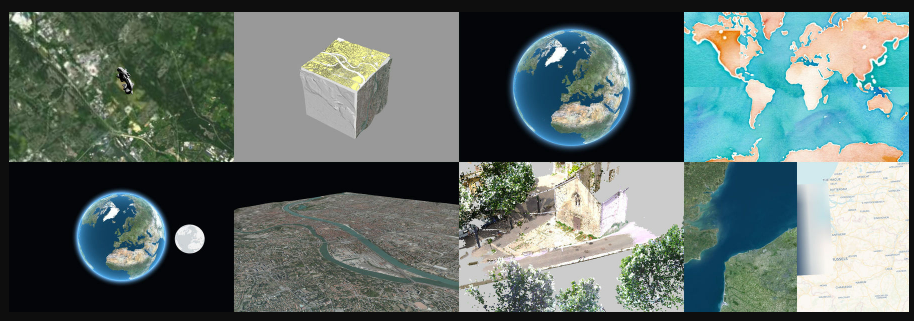
  • Visualizes 3D geospatial data
  • Connects to various servers
  • Loads different data formats, including 3dTiles, GeoJSON, Vector Tiles, GPX, and more
  • Targets the last two major versions of Firefox, Safari, and Chromium-based browsers
  • Supports WMS/WMTS/TMS servers, including elevation data
  • Older browsers supporting WebGL 2.0 may work but support is not offered

License

iTowns is dual-licenced under Cecill-B V1.0 and MIT. Incorporated libraries are published under their original licences.

Resources & Downloads

GitHub - iTowns/itowns: A Three.js-based framework written in Javascript/WebGL for visualizing 3D geospatial data
A Three.js-based framework written in Javascript/WebGL for visualizing 3D geospatial data - iTowns/itowns
iTowns


Open-source Apps

9,500+

Medical Apps

500+

Lists

450+

Dev. Resources

900+

Read more

Bias in Healthcare AI: How Open-Source Collaboration Can Build Fairer Algorithms for Better Patient Care

Bias in Healthcare AI: How Open-Source Collaboration Can Build Fairer Algorithms for Better Patient Care

The integration of artificial intelligence (AI), particularly large language models (LLMs) and machine learning algorithms, into healthcare has transformed the industry dramatically. These technologies enhance various aspects of patient care, from diagnostics and treatment recommendations to continuous patient monitoring. However, the application of AI in healthcare is not without challenges.